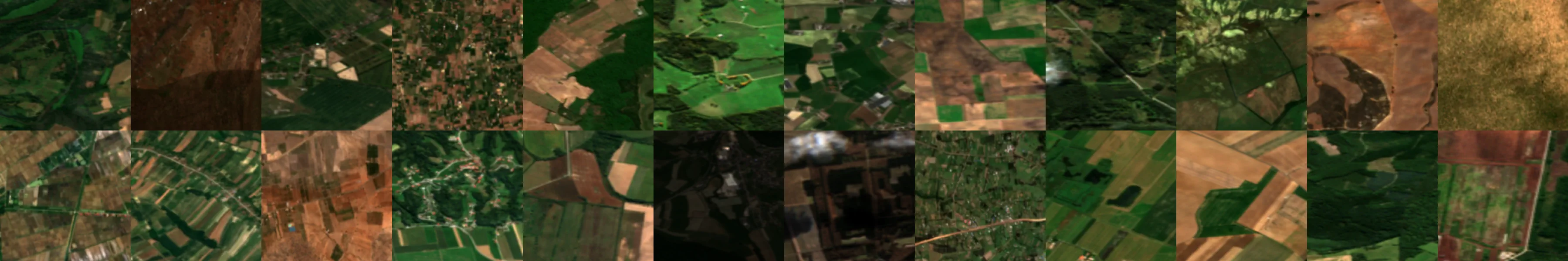
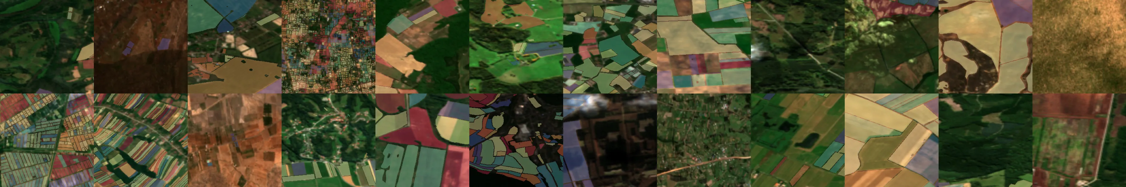
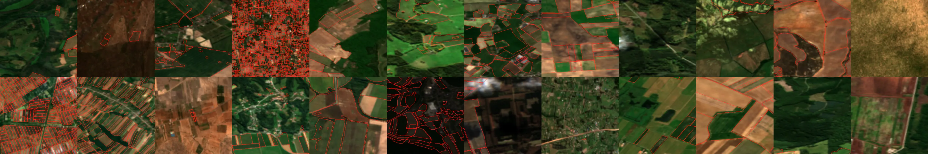
There is a growing need for accurate and scalable field boundary data for global agricultural monitoring and assessments. By combining open satellite imagery with machine learning, we aim to build a global, open, and regularly updated map of the world's fields. The intention is that these field boundaries will enable better land use monitoring, food security efforts, and agricultural insights.
The goal of Fields of The World (FTW) is to build a global field boundary dataset. The effort originally launched as a benchmark dataset, which is still the core of the effort. FTW has expanded into a full ecosystem supporting research, development, and deployment of geospatial workflows for the cloud.
Most countries don't have comprehensive maps of their agricultural fields, and even fewer have up-to-date information on what crops are growing or whether sustainable practices are being used. Our approach to solving this is to leverage Earth observation data and AI to automatically detect field boundaries at scale.
FTW is sponsored by Taylor Geospatial, in collaboration with the ASU Kerner Lab, Microsoft AI for Good, and Washington University in St. Louis, together with a broad community of researchers, technical fellows, and geospatial practioners working to improve field boundary detection.
Key Features
Complete Ecosystem
Beyond the benchmark dataset, FTW provides baseline models, inference tools, web applications, and data products to support end-to-end field boundary workflows.
Global Impact
By combining open satellite imagery with machine learning, we aim to build a global, open, and regularly updated map of the world's agricultural fields.
Community Driven
FTW is an open, community-driven initiative where individuals and organizations can contribute data, models, tools, and expertise to advance global agricultural intelligence.
Why?
Get Started
Get Involved
We welcome contributions from the community! Our goal is to create an open, collaborative ecosystem where we all work together to advance a commons of data, models, benchmarks and software for agricultural insights.