A global field boundary ecosystem
Fields of The World (FTW) is an open ecosystem for agricultural field boundary detection — combining a global benchmark dataset, baseline ML models, inference tools, and web applications.
Most countries lack complete maps of their agricultural fields. FTW uses open Sentinel-2 satellite imagery and machine learning to detect and map field boundaries at scale — supporting land use monitoring, food security assessment, and crop analysis worldwide.
 Co-Developed By
 Academic Partners
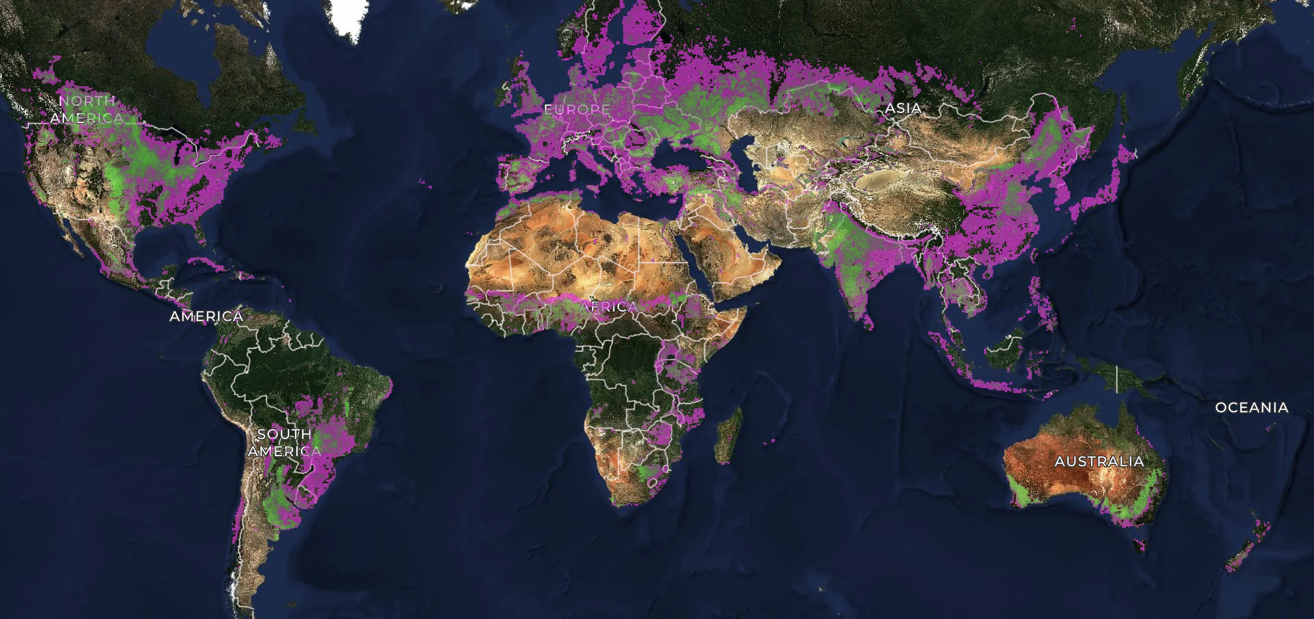
A global 10m field boundary dataset covering 2024 (1.62B polygons) and 2025 (1.55B polygons), produced by running the FTW PRUE model worldwide. Funded by Taylor Geospatial and run on the Wherobots RasterFlow platform. Browse in the Explorer App or download from Source Cooperative. See the preprint for more information.
Tutorial materials and Colab notebooks are available at iclr2026-ml4rs-tutorial. Read the paper on arXiv
The FTW PRUE paper was accepted to CVPR 2026. Code is open source at ftw-prue and models are runnable via the ftw-tools package. Read on arXiv
Our tutorial on agricultural monitoring with FTW was accepted to the NeurIPS 2025 CCAI Workshop. Materials are open source at climatechange-ai-tutorials/agricultural-monitoring-ftw. Run the Colab notebook
Taylor Geospatial published an update on the second phase of FTW — expanding the dataset, scaling inference infrastructure, and shipping open ML tools for global field boundary mapping. Read the update
1.6M+ labeled parcels across 24 countries, openly licensed. Download the dataset
Taylor Geospatial announced the launch of the Fields of The World initiative — a global open benchmark and ML infrastructure effort for agricultural field boundary detection. Read the launch post
Open progress calls every other Thursday at 8 am PT / 11 am ET. Join the mailing list to receive calendar invites.
Explore the global dataset or run inference yourself
Pan the world map to browse 3.17B field boundaries, download polygons for any region, or optionally run inference directly in your browser — pick a model and a Sentinel-2 tile and go. No code, no setup, no downloads required.
The full dataset is publicly available on Source Cooperative. The predictions and Sentinel-2 mosaics are also available through the Earthmover Marketplace.
A community-driven commons
FTW is built in the open. Contribute data, models, tools, or help spread the word — all contributions are welcome.
Benchmark Dataset
1.6M+ labeled parcels across 24 countries, unified for training and evaluation. Share or open-license more datasets — file an issue.
Baseline Models
Pretrained baselines including FTW PRUE, runnable via ftw-tools. Train improved models — see the experiments guide.
Tools, Apps & API
Explorer App, CLI, and open API for browsing, downloading, and producing fiboa-compliant output. Improve the CLI, web apps, or QGIS integration — see open issues.
Promotion & Education
Blog posts, talks, papers, tutorials, social media — help spread the word.